


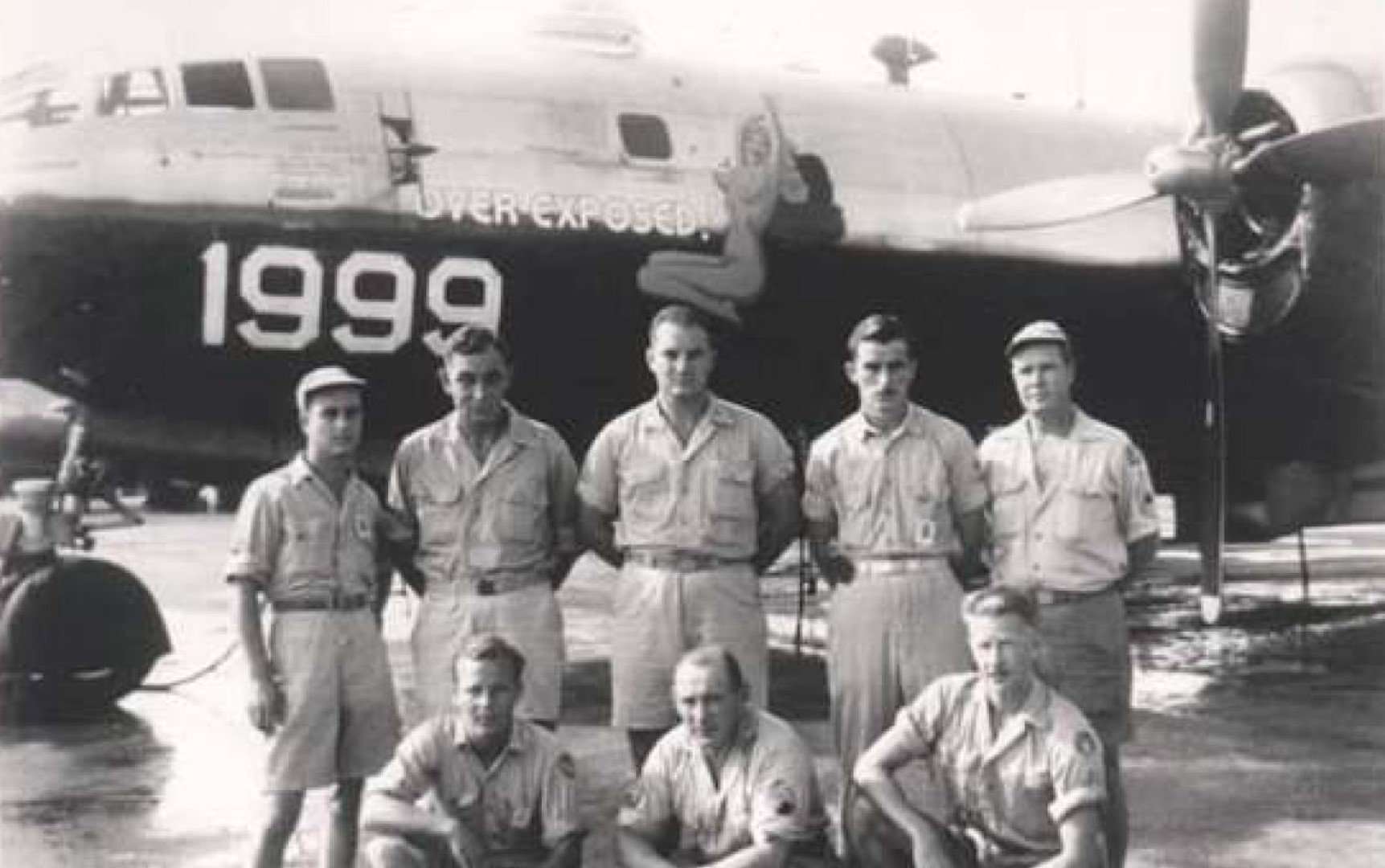
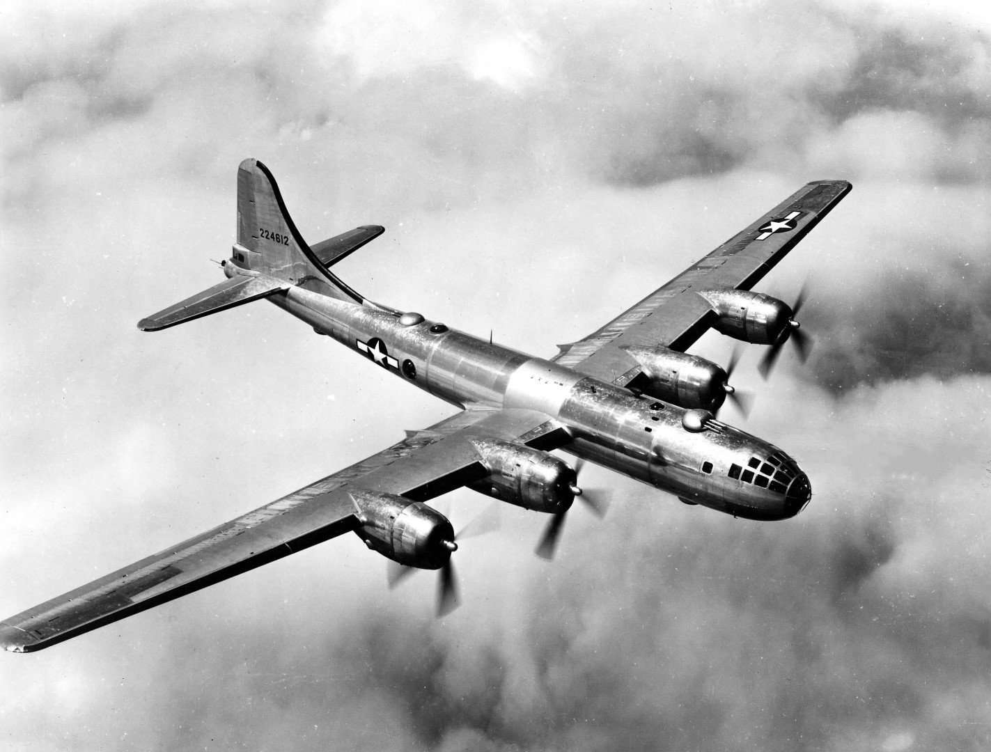
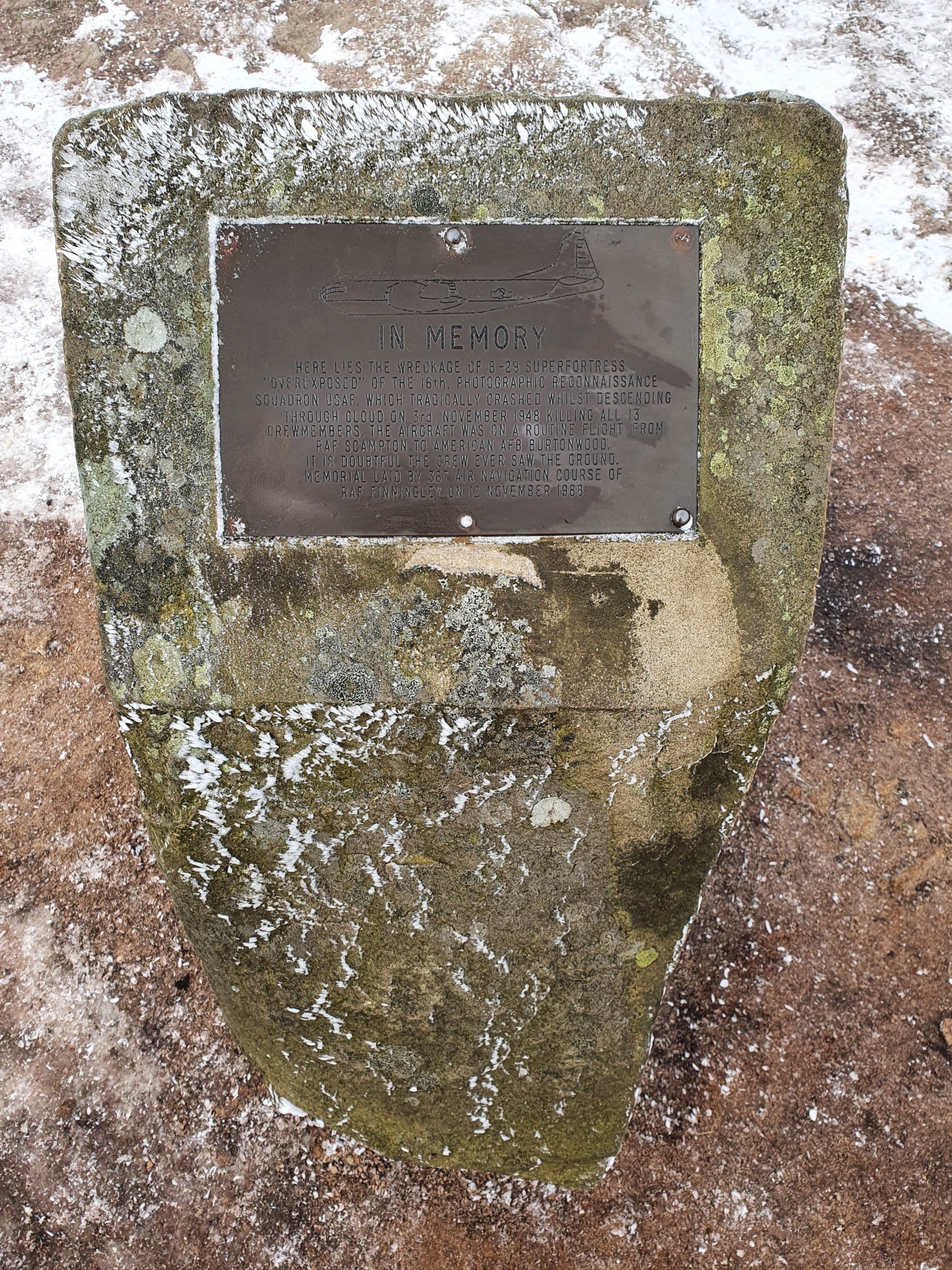
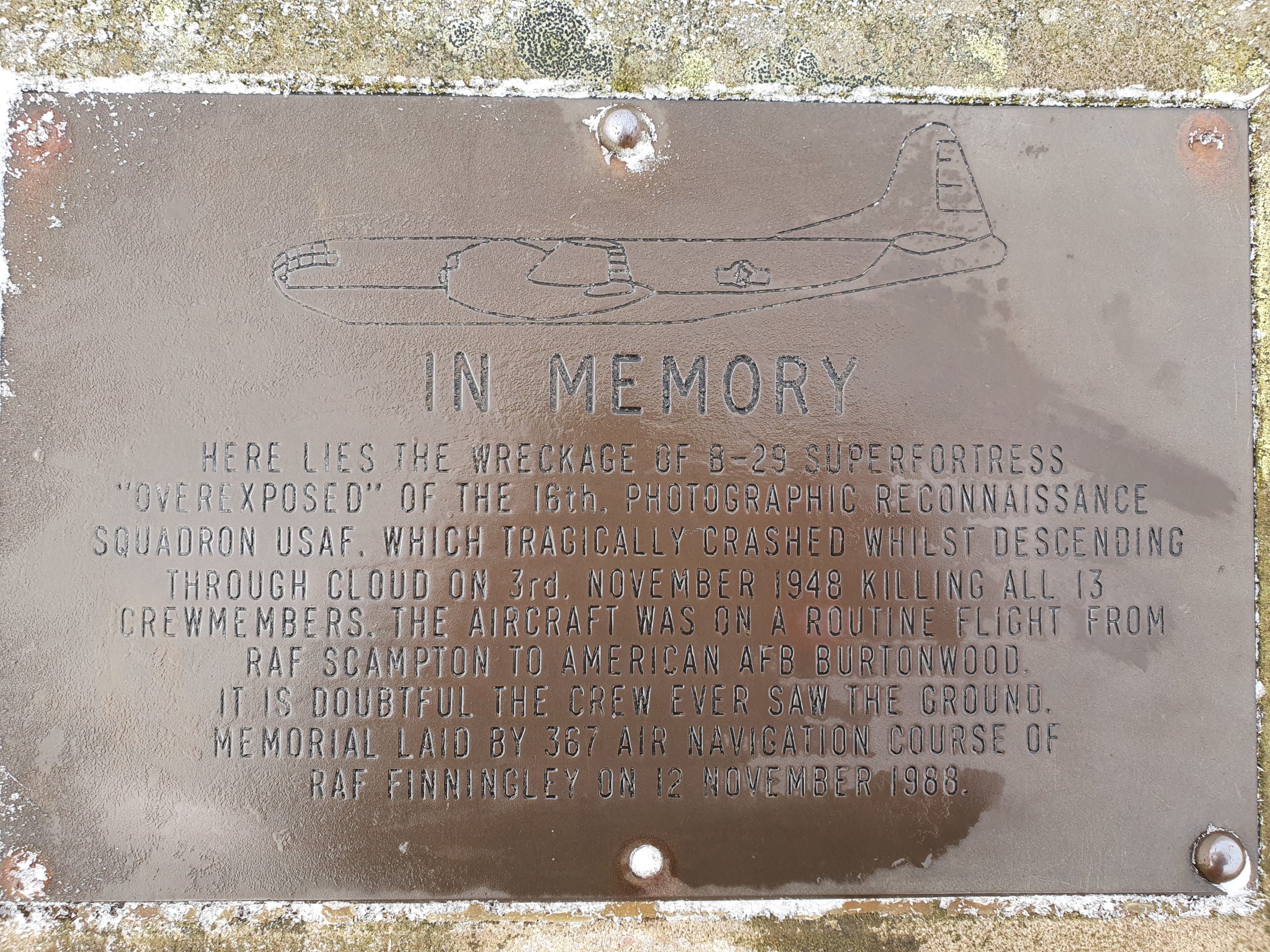
High in the hills above Glossop, in the northern part of the Peak District, lies the wreckage of the Bleaklow Bomber… a US Air Force B-29 Superfortress Bomber turned reconnaissance plane, named Over Exposed.
After serving in World War II, the plane crashed on 3rd November 1948 during a routine daytime flight killing all 13 crew members. Although not confirmed, it’s thought either faulty navigation equipment or pilot error caused by the bad weather and low clouds on the moor led to the plane descending too soon, believing that they were clear of the hills. Instead, they crashed close to the highest point of Bleaklow at over 2,000 feet.
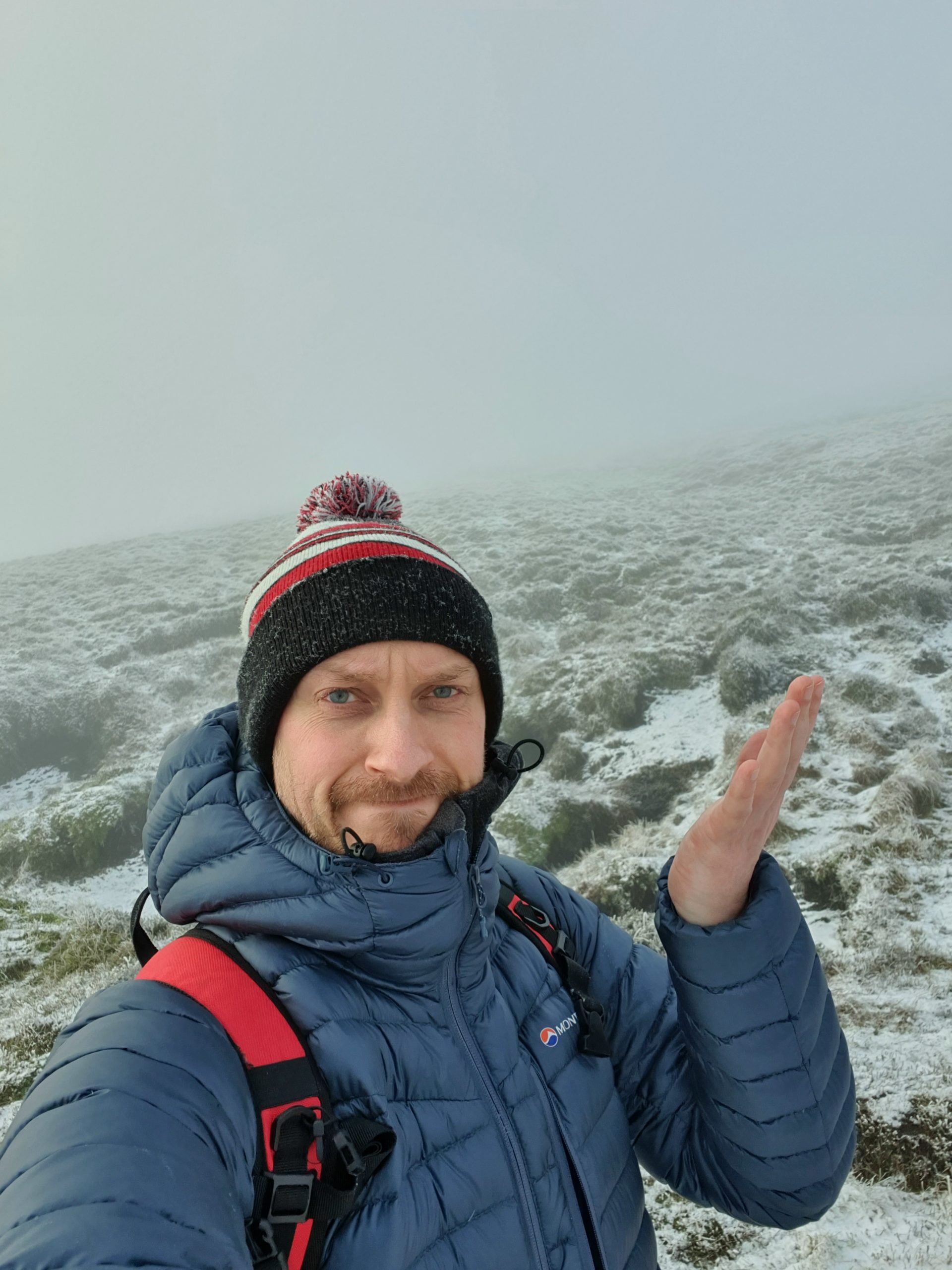
I’d first planned to do this walk to the crash site with some friends last year, but a last-minute work-trip abroad meant I had to drop out and let them go on without me. But in need of some exercise after the usual overindulgence over Christmas, wanting to get out and test the new coat I got, and seeing on Facebook that it had snowed in Eastern Manchester near Glossop, I decided to attempt the walk on my own.
Driving over the M62 the fog is so dense I can barely see the cars in front of me, and I begin to wonder what it might be like up on top of the moor! I read a few weeks ago that the local Mountain Rescue had issued warnings to inexperienced hikers trying to find the crash site as it had become a popular hunt during lockdown, but with conditions on the moor changeable in an instant, lots of people were getting caught out and having to be rescued. While I wouldn’t call myself a novice hiker, I also wouldn’t claim to be hugely experienced either!
As I drive up Snakes Pass and park at the Doctor’s Gate entrance to the moor I find out… low cloud, a light covering of snow, and very very cold! But I’ve come prepared (they say there’s no such thing as bad weather, only bad clothing), so here goes…
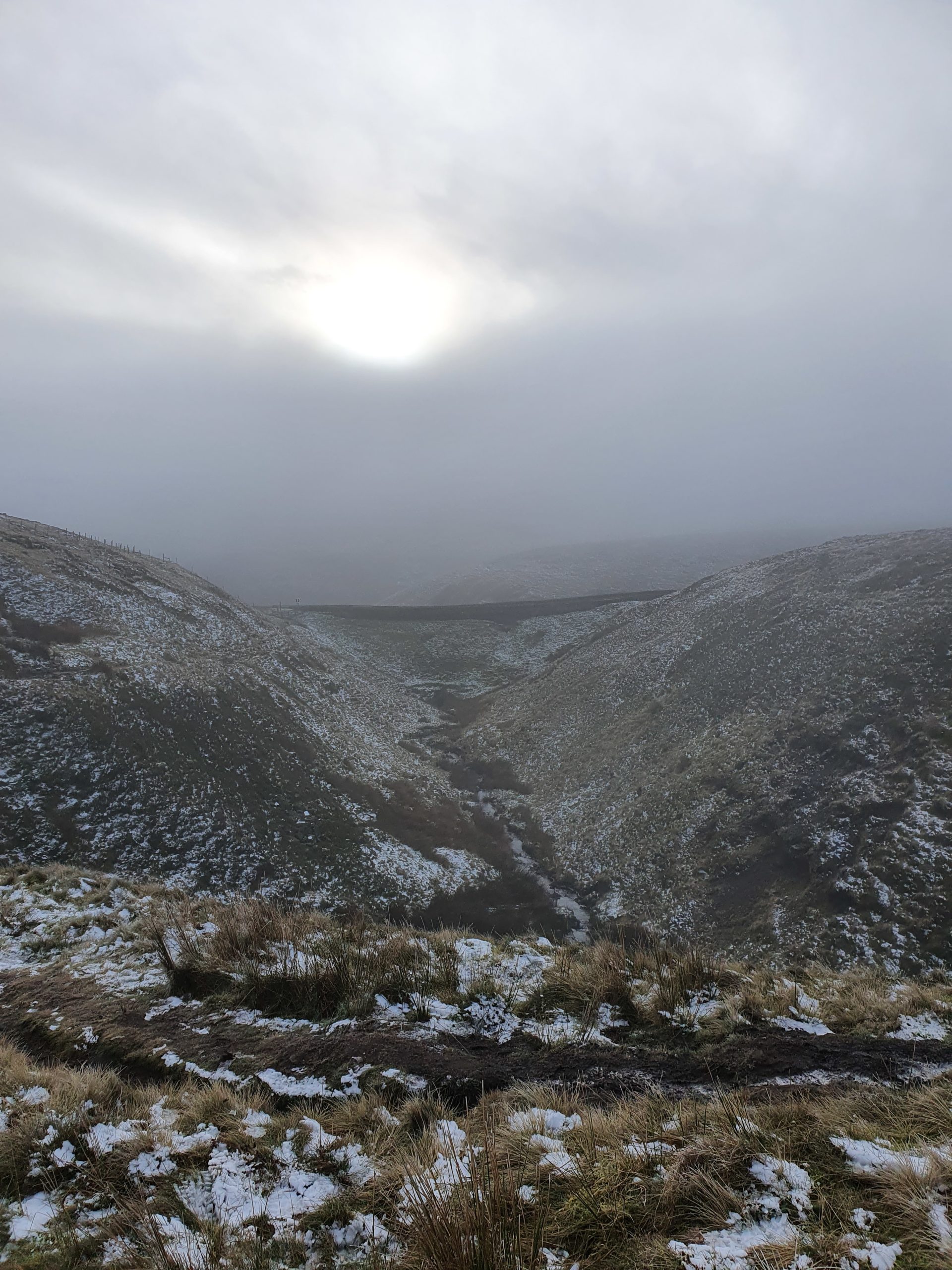
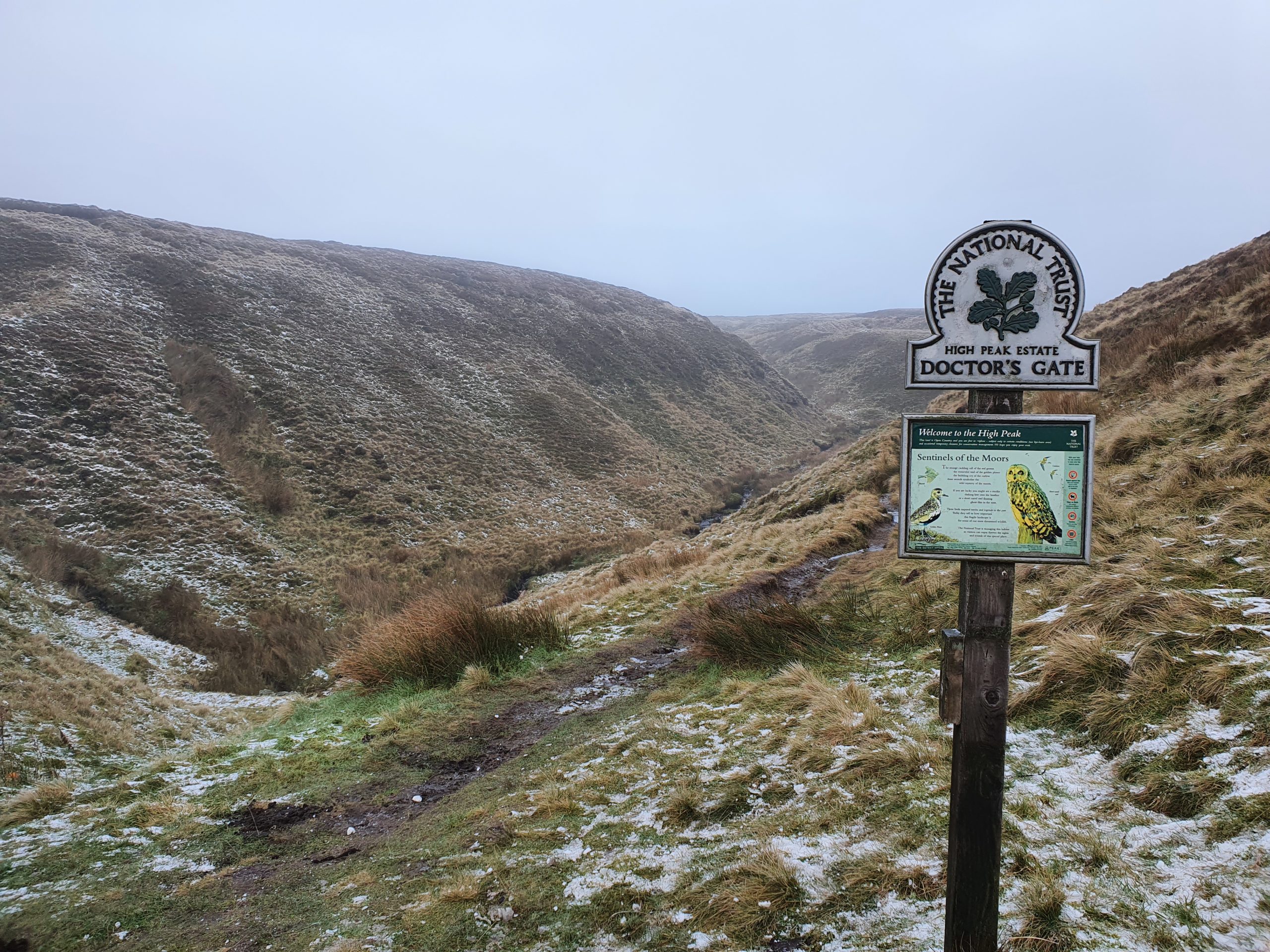
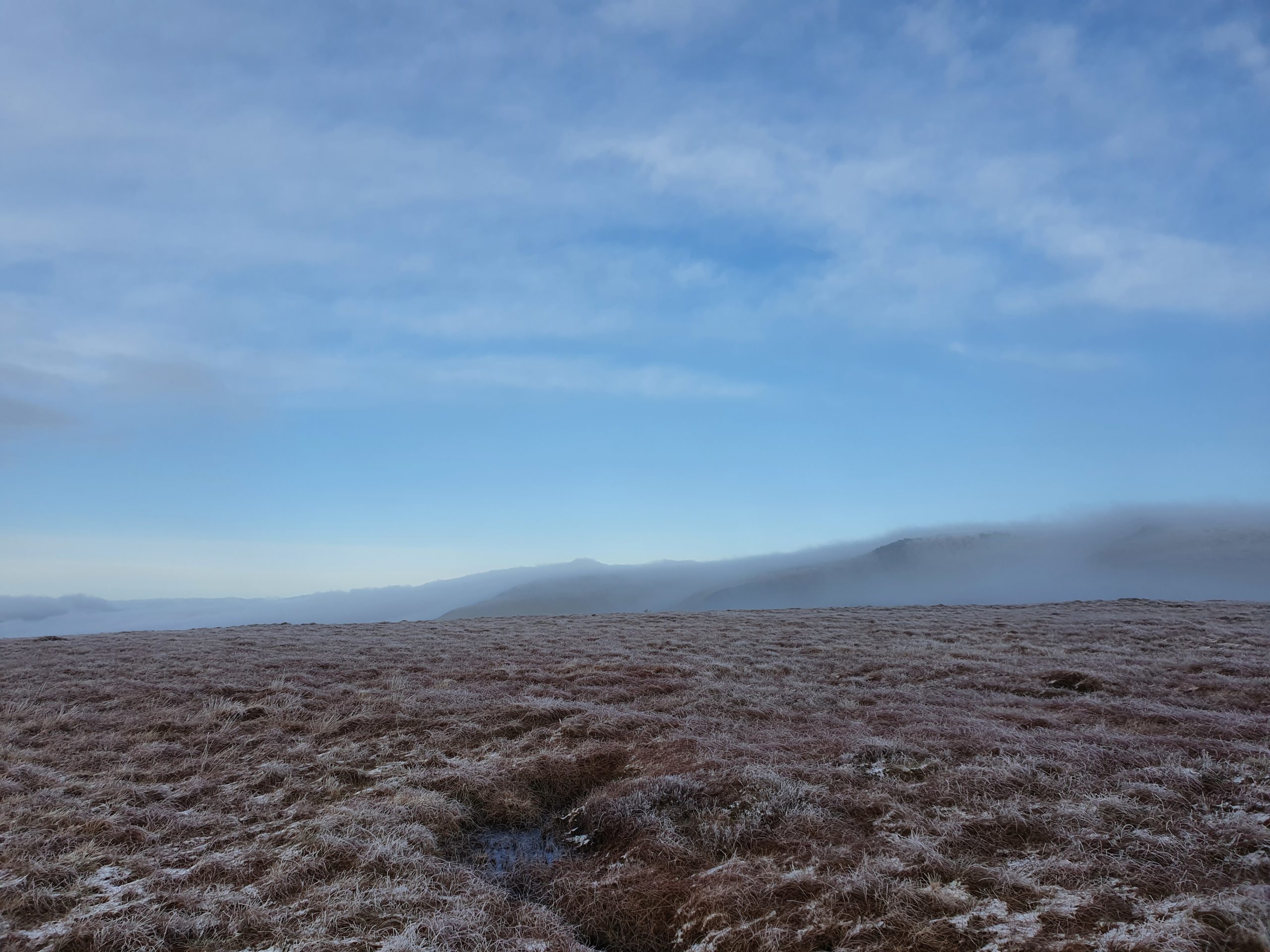
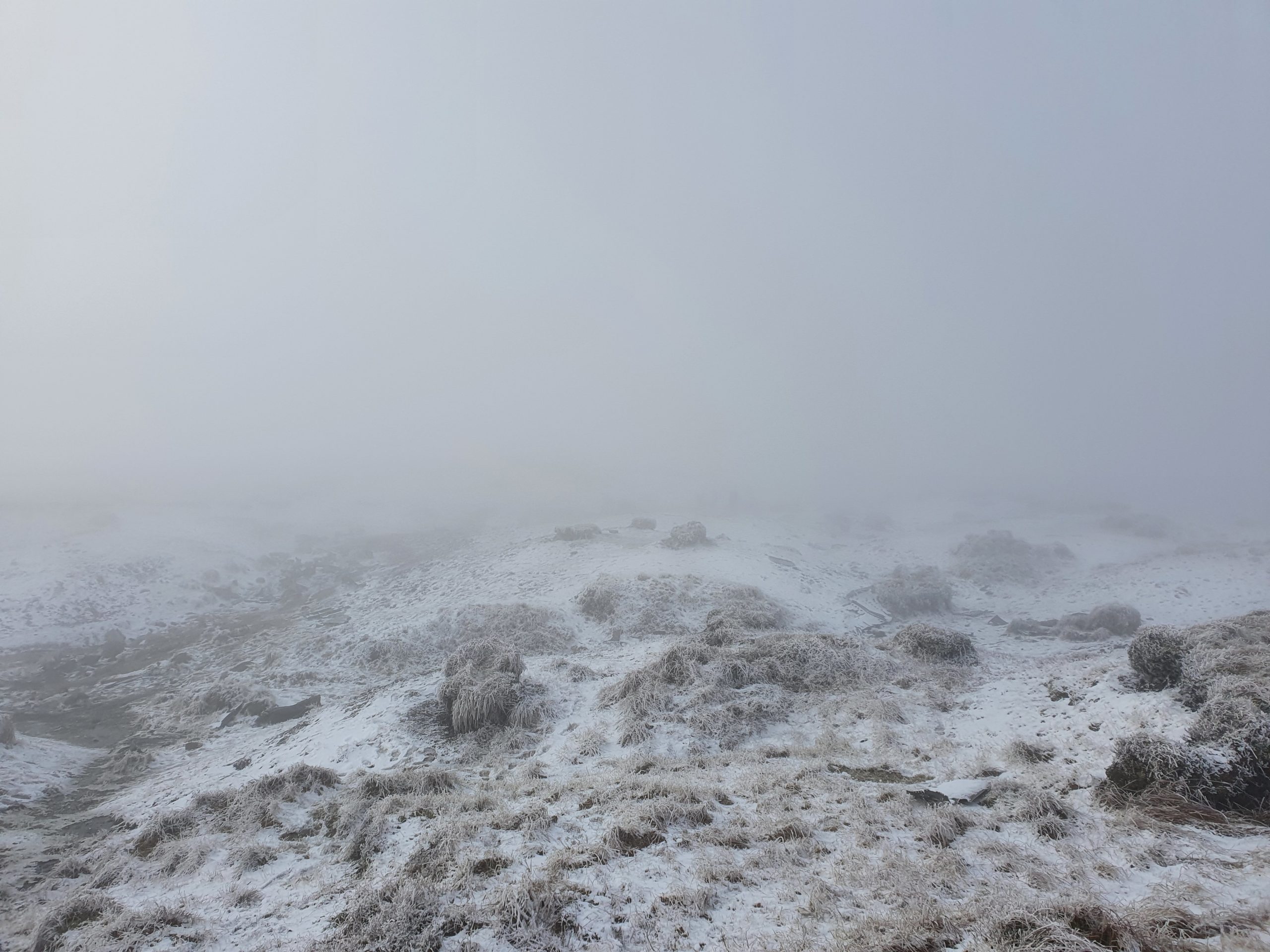
I enter the moor via Doctor’s Gate (an old Roman road) and follow it up into the hills for about 15-minutes, until the trail meets and crosses Pennine Way. With the low cloud and poor visibility over the barren landscape, and the squawks of the birds overhead ringing around, it makes for a very desolate setting!
Pennine Way appears to be busier though with lots of dog walkers following the paved footpath, so after cutting across the moor for some photos over the edge of the hill, I join them and head north towards the crash site.
The dog walkers don’t last for long though and I’m soon alone again as the footpath turns into a mud path, and then forks with a layer of ice covering the ground. My phone says it’s now -4°C, a lot of the puddles are covered in ice, and the snow is getting thicker, but I’m feeling toasty in my new coat… so far so good!
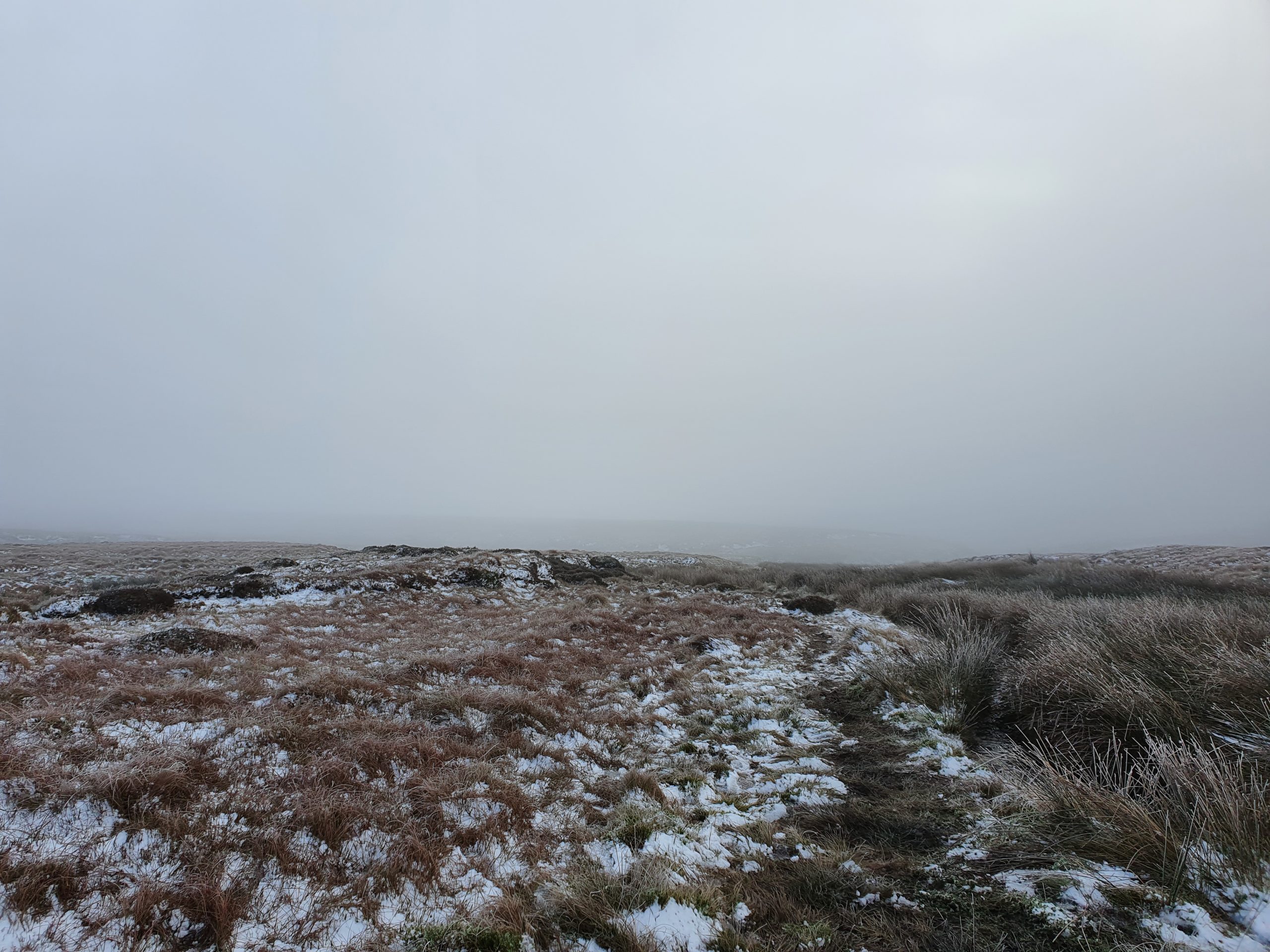
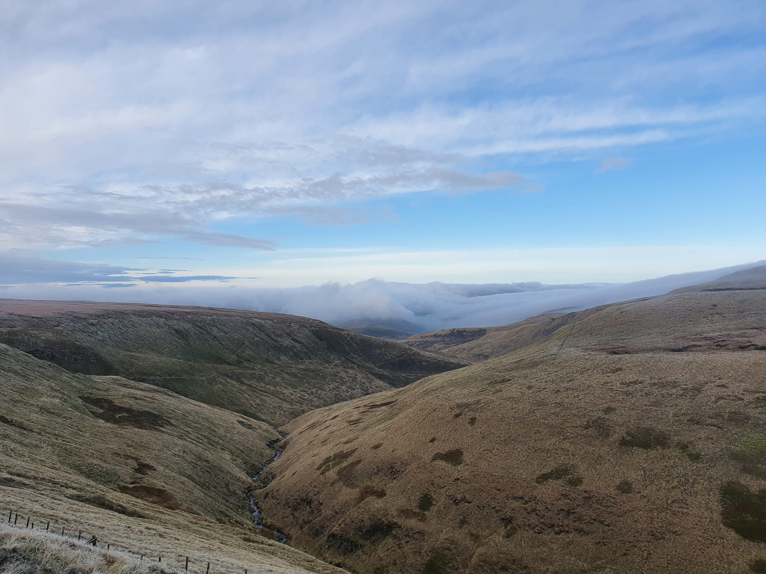
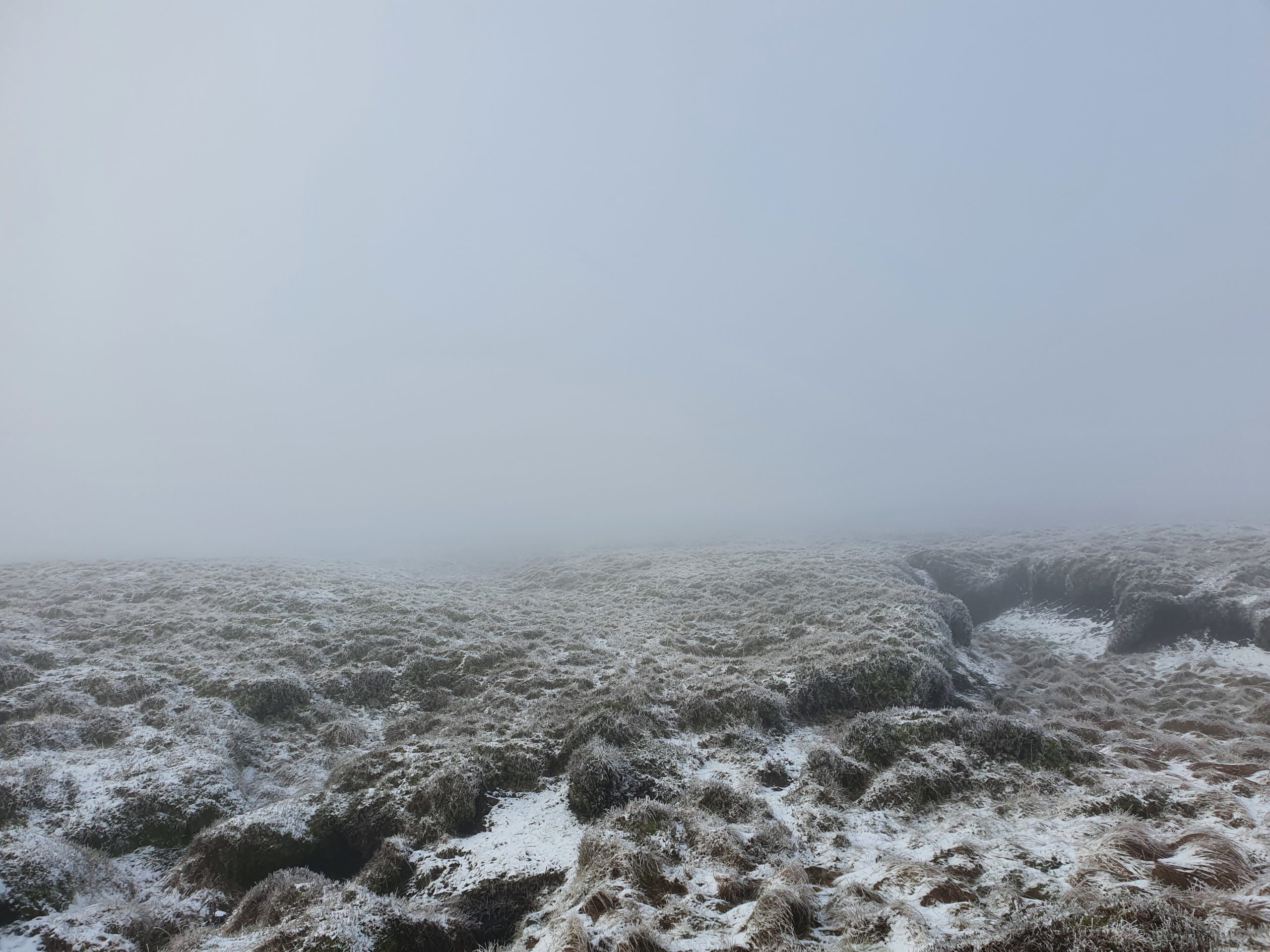
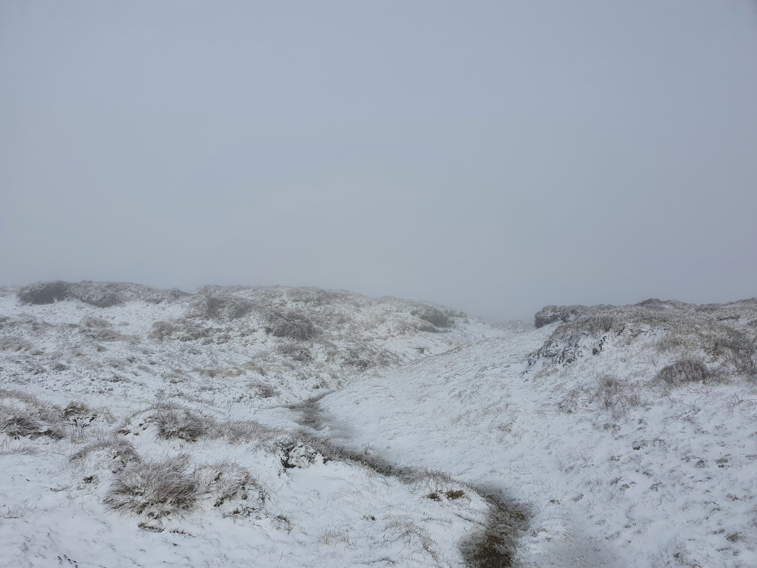
I’m still following what I think is the Pennine Way, but with the landscape now dominated by peat groughs (deep channels in the ground, some of which are deeper than I am tall) all winding in different directions, I’m not 100% sure! Luckily I have enough phone signal for my GPS and Google maps to work, and it confirms I’m still on the right track!
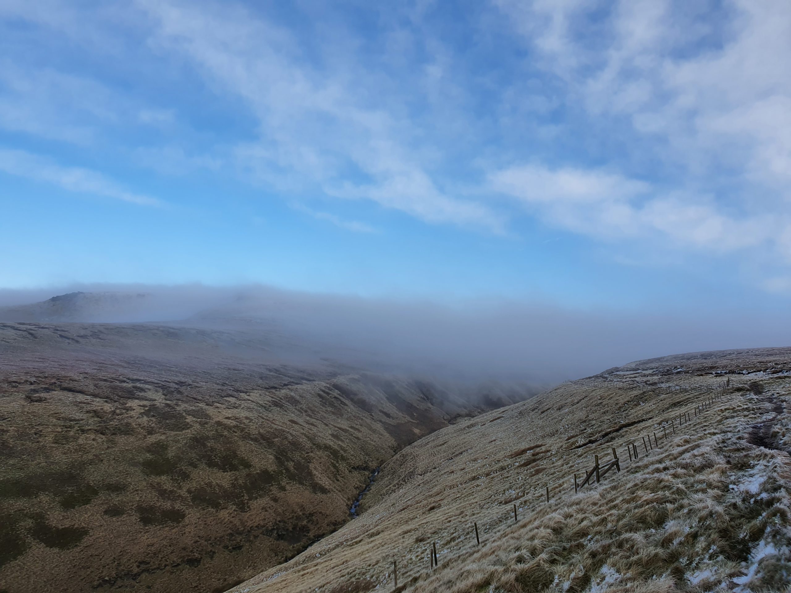
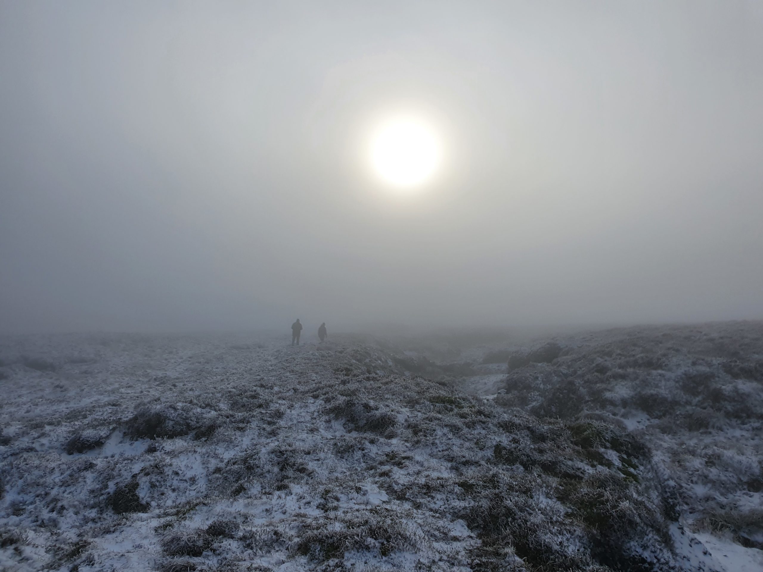
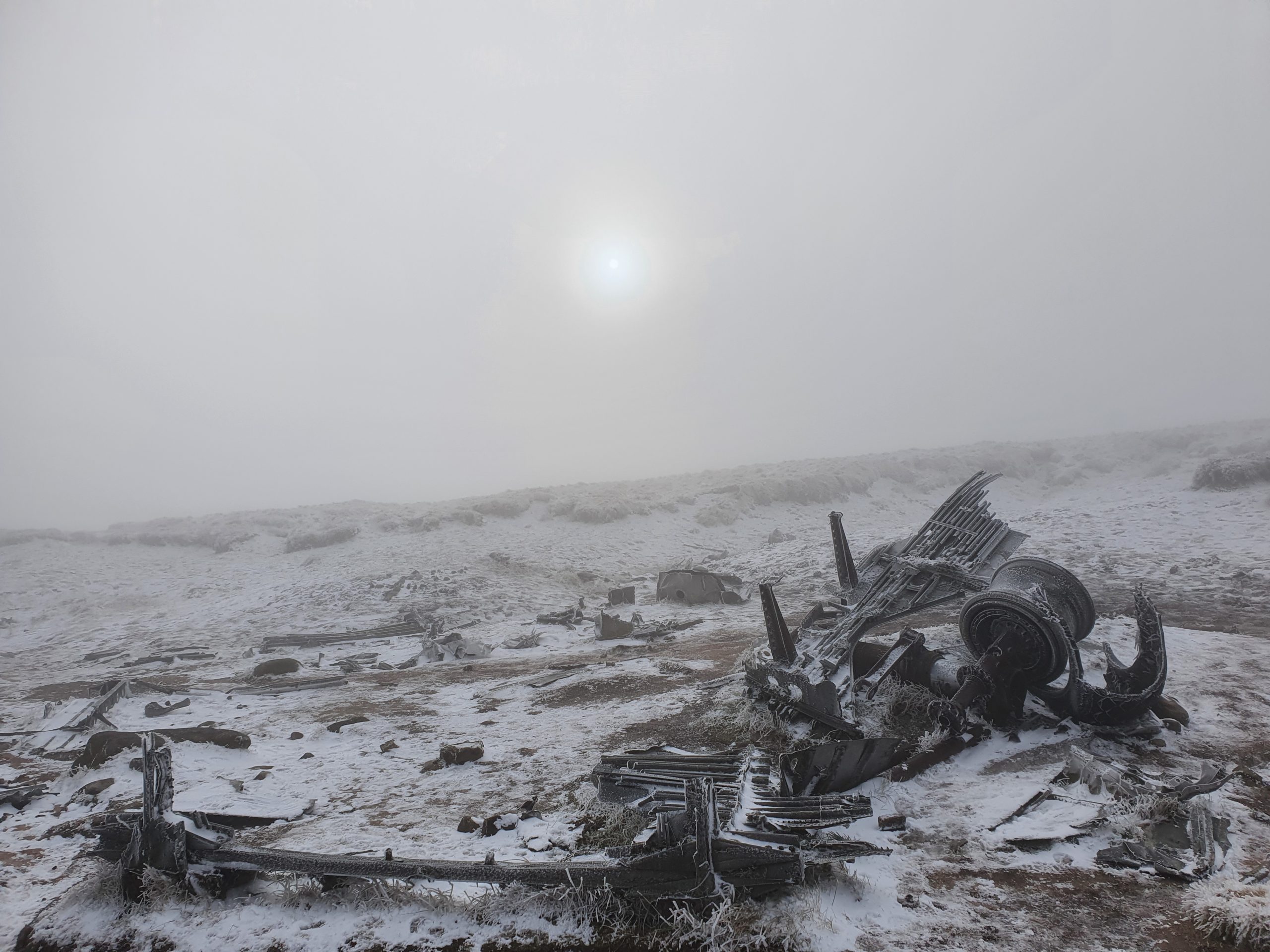
The plane wreckage isn’t situated on the trail however, and so at some point I need to leave it and head across the barren moorland again. As I make a start the sun is trying to break through the thick cloud, but rather than improve the visibility, all it does is cause a haze which adds to the eery wilderness!
Trying to stay in a straight line and remember anything significant on the landscape which might help my return journey isn’t easy, and after a while I start to wonder if I should call it a day, give up, and head back while I still know how to make it back! I’m pretty sure I’ve ticked nearly every box of the don’t do list so far… don’t leave the trail, don’t rely on your phone without a proper map, compass or GPS, don’t go it alone etc.…
Just as I’m feeling a bit lost and trying to get my bearings I hear some voices, and two guys emerge from the haze and come over to me. “Do you know where the plane wreck is?” they ask. “I think it’s over that way” I say as I point into the abyss. “Yeah that’s what some other people just said who we saw, but we can’t find it. The cloud is too low to see anything”.
After a minute or so’s chat and offering to team up to find it together, they decide to give up and head off back in the direction of the trail. As they head into the distance it almost looks like something from a post-apocalyptic movie… the last human contact I’ll have before getting lost on the moor! Before they completely disappear I reconsider my options… do I follow them and admit defeat, or do I push on and try and find the site?
It’s taken me just over an hour to get this far and there’s at least 4 hours of daylight left, the 4G still seems to be working on my phone, and with the sun now visible through the clouds to help guide me back in the right direction, my decision is made… let’s carry on!
And I’m glad I do… after another 10-minutes or so I come over the crest of a hill and can see some out-of-place looking objects on the ground up ahead… yes, I’ve made it!
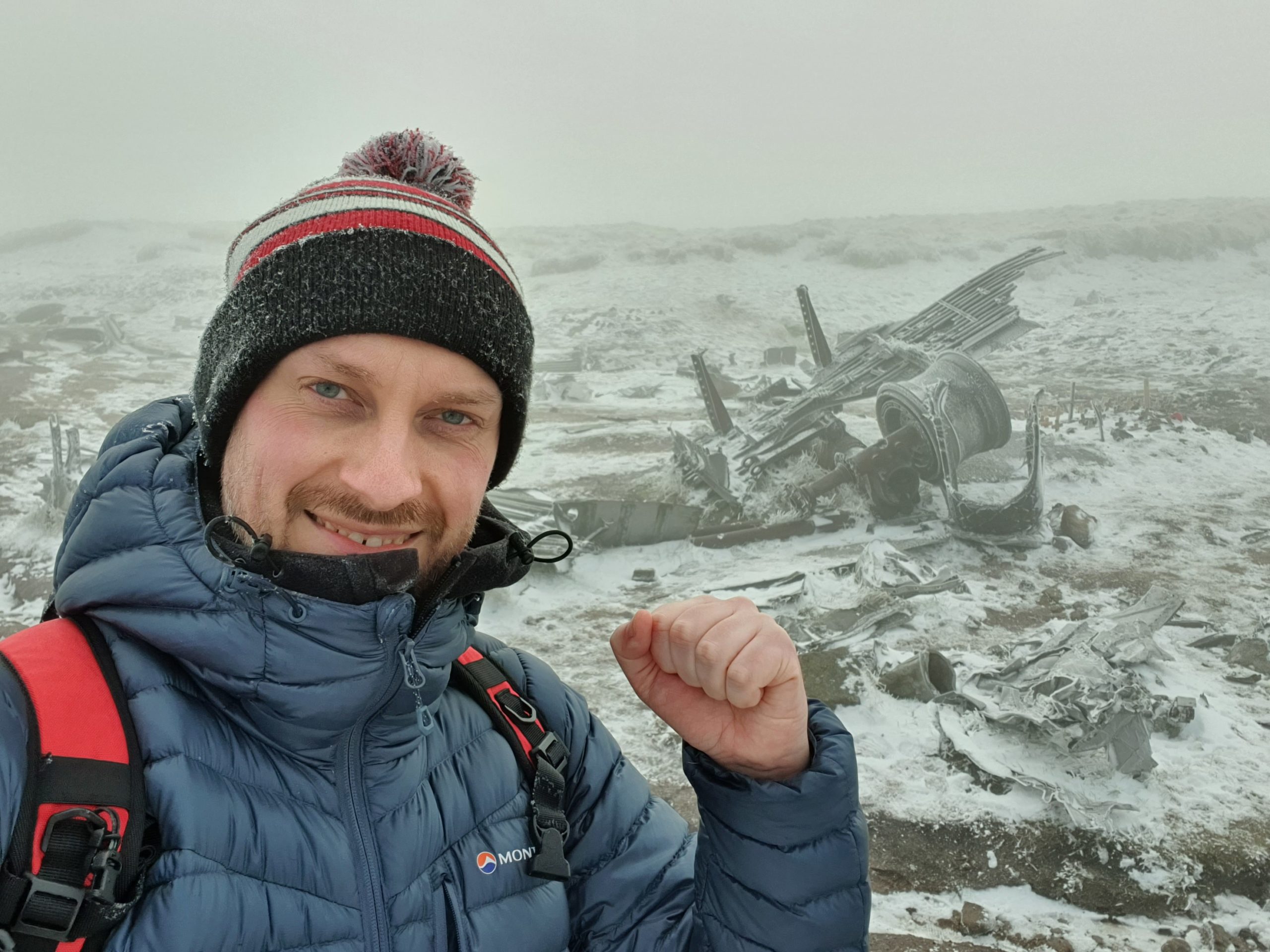
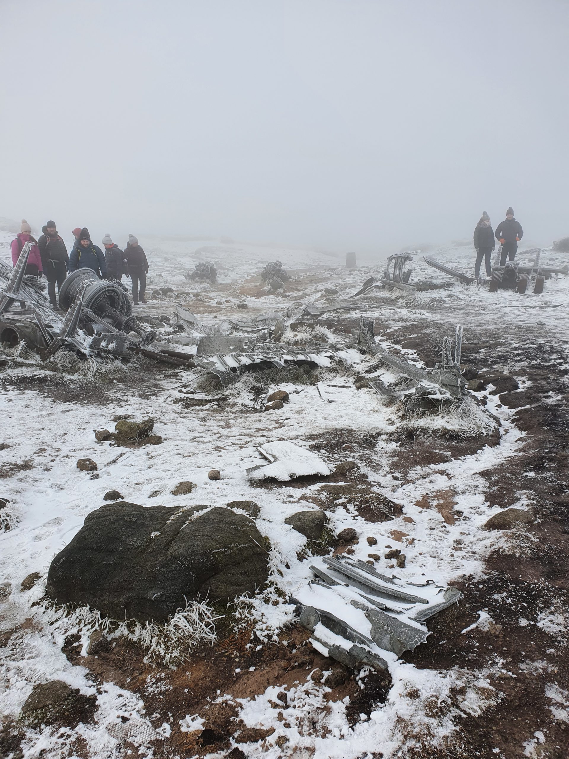
As I get closer I can hear voices, and for once I’m glad to see other people crowding around a sight and making a clear photo opportunity difficult to capture!
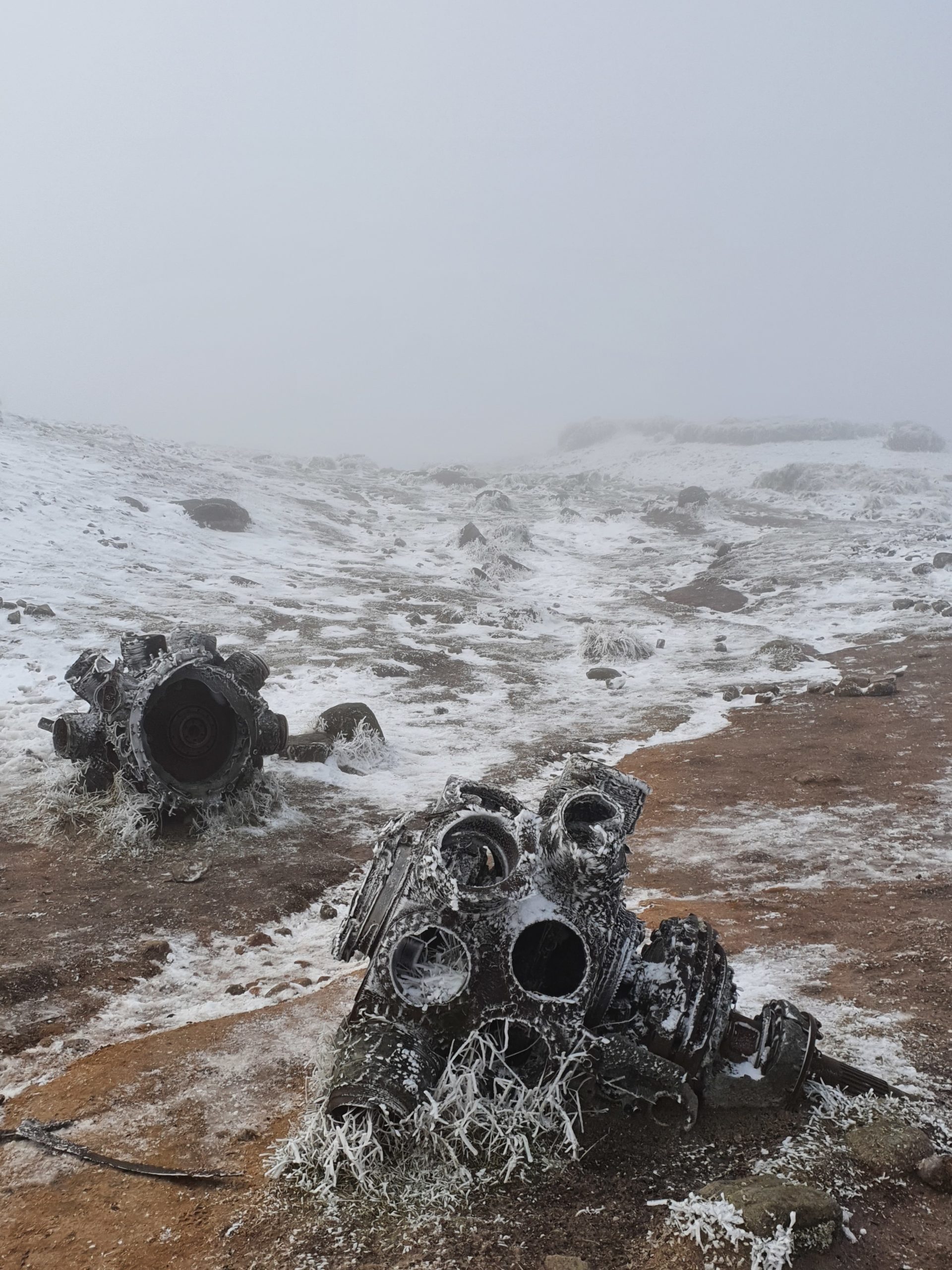
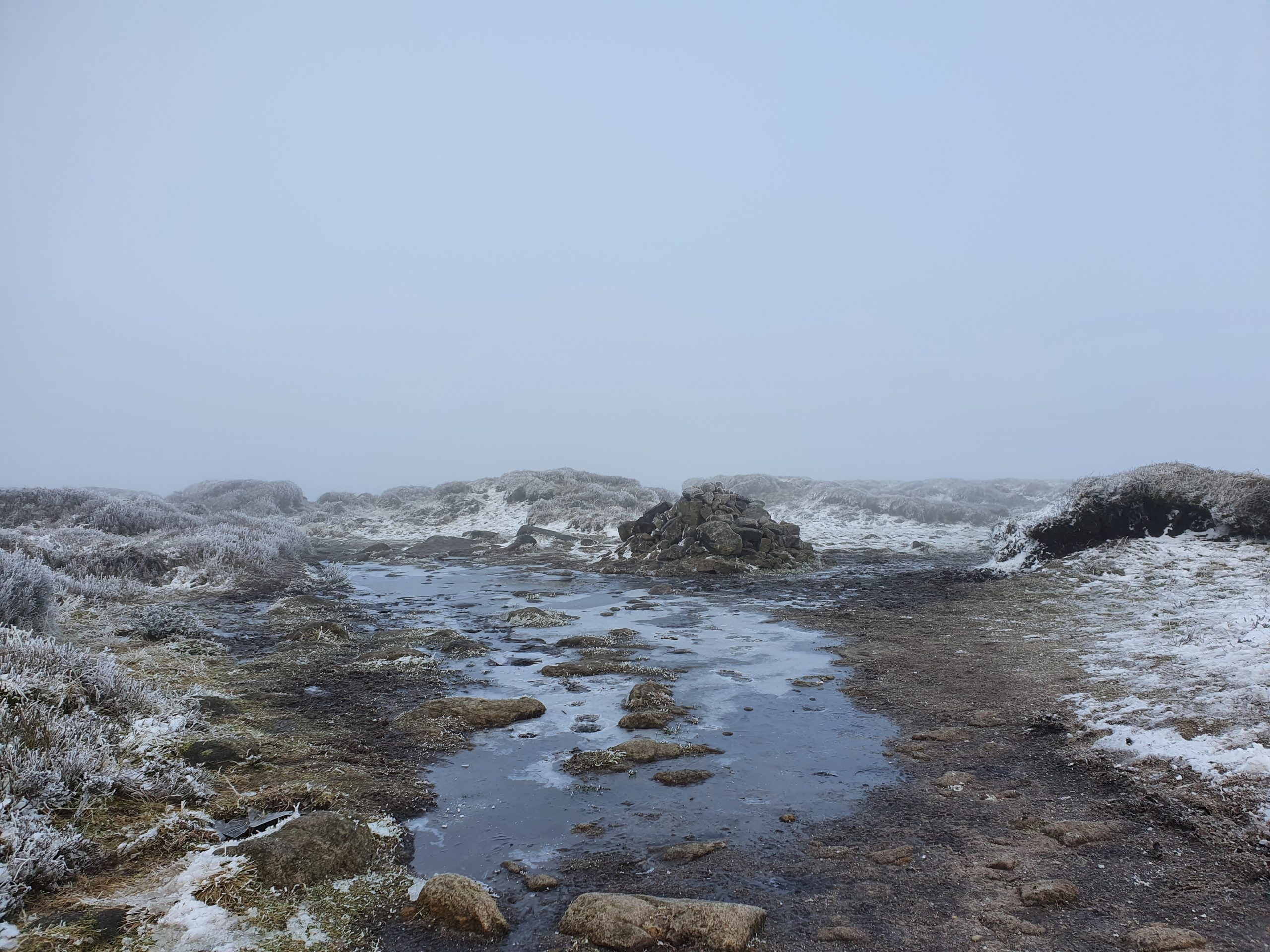
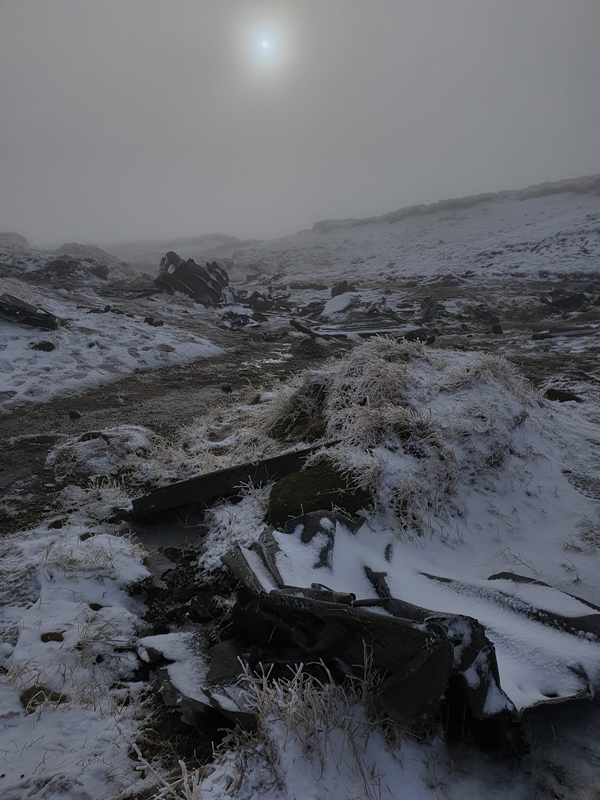
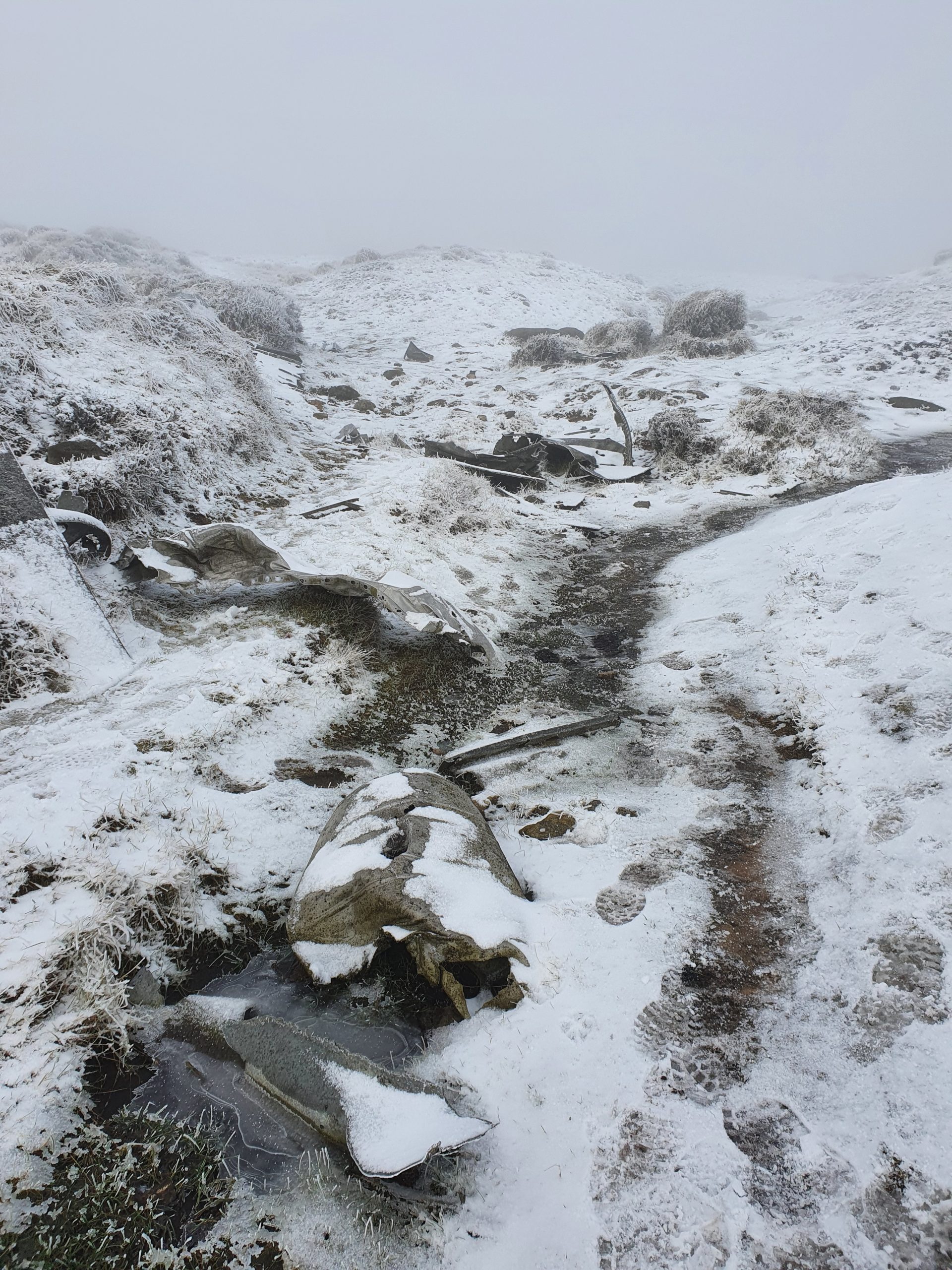
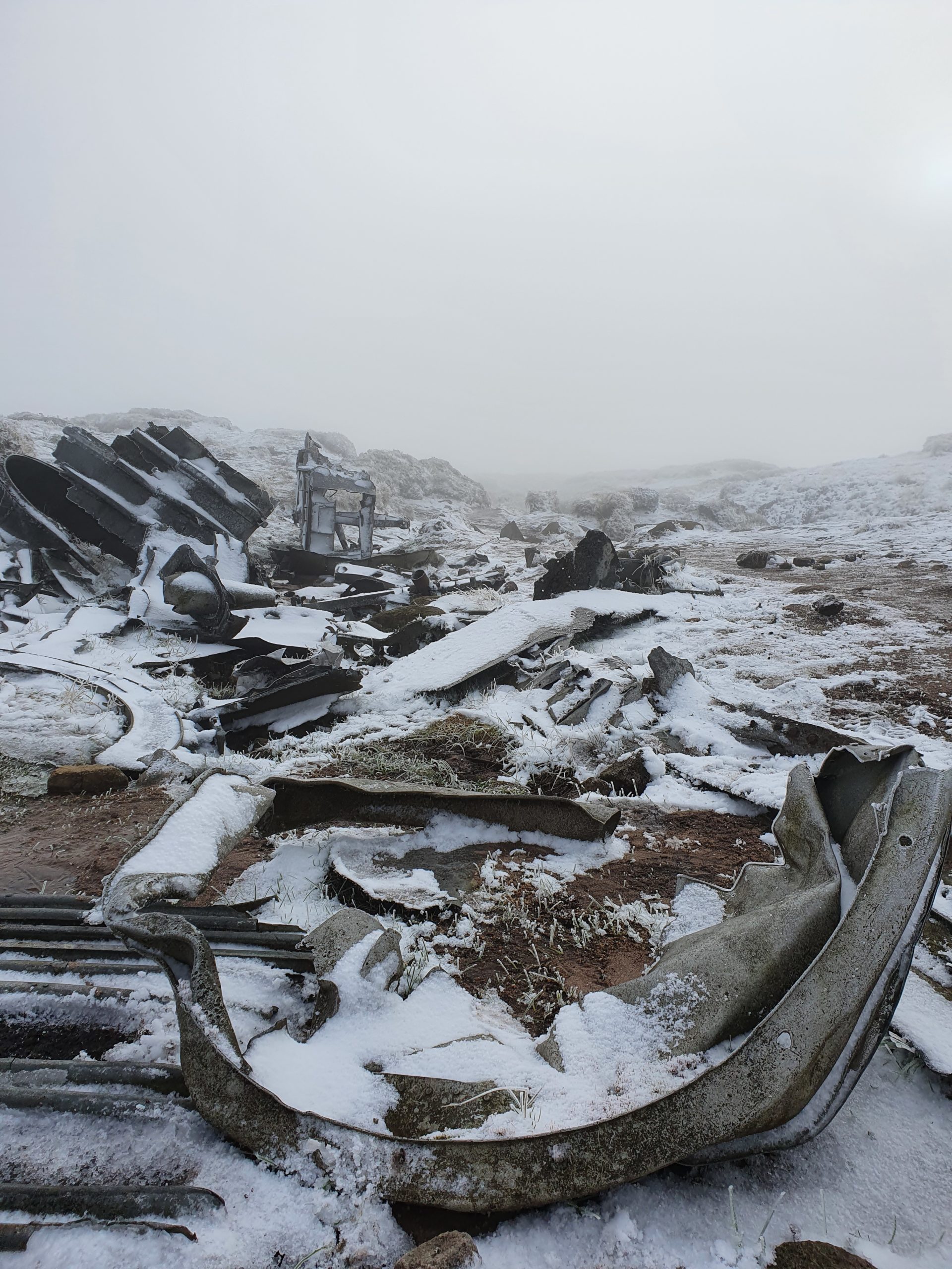
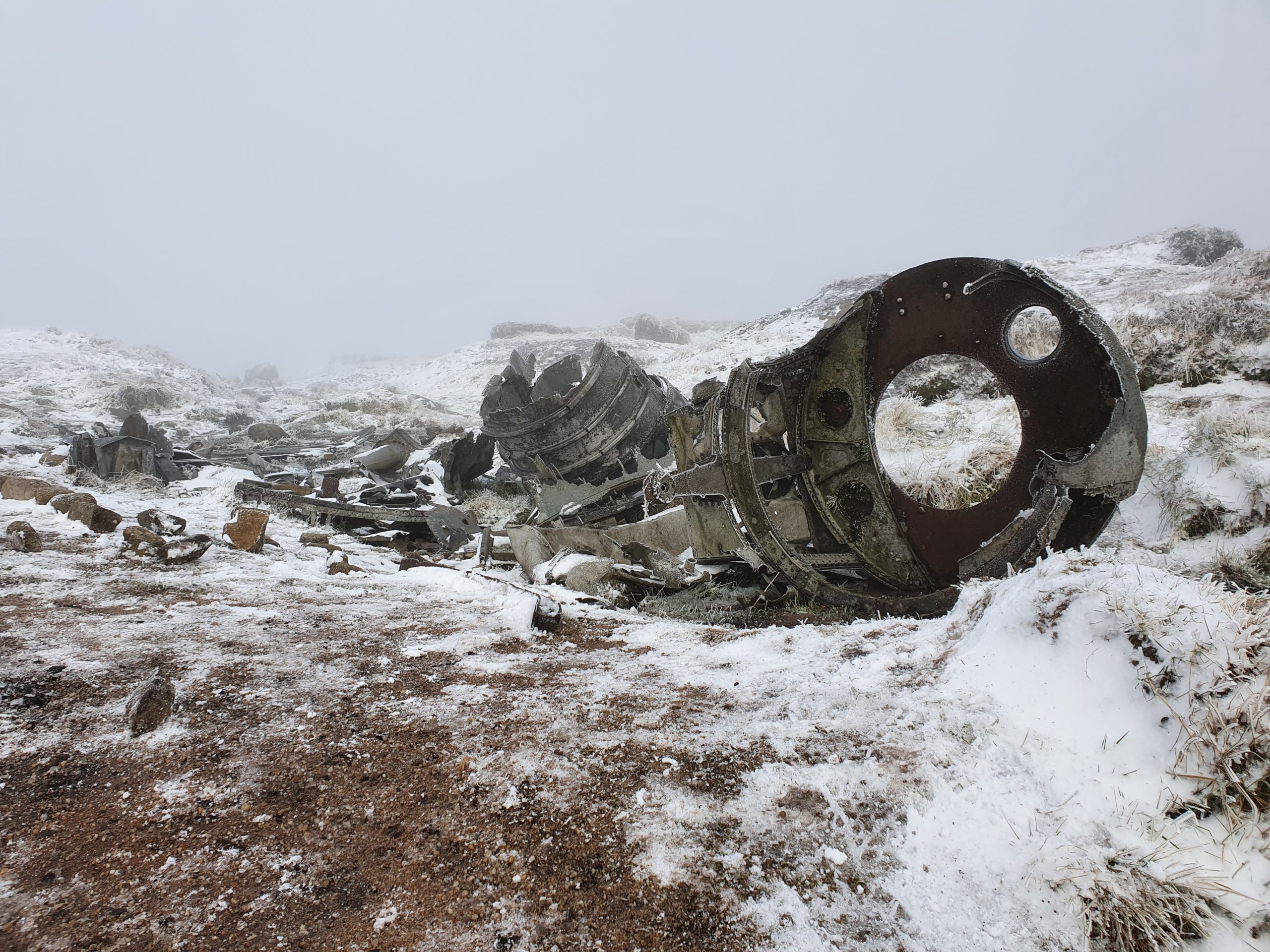
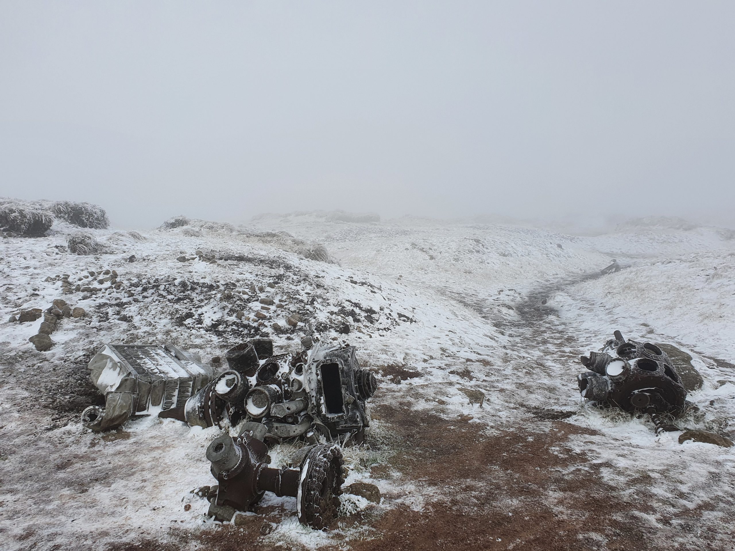
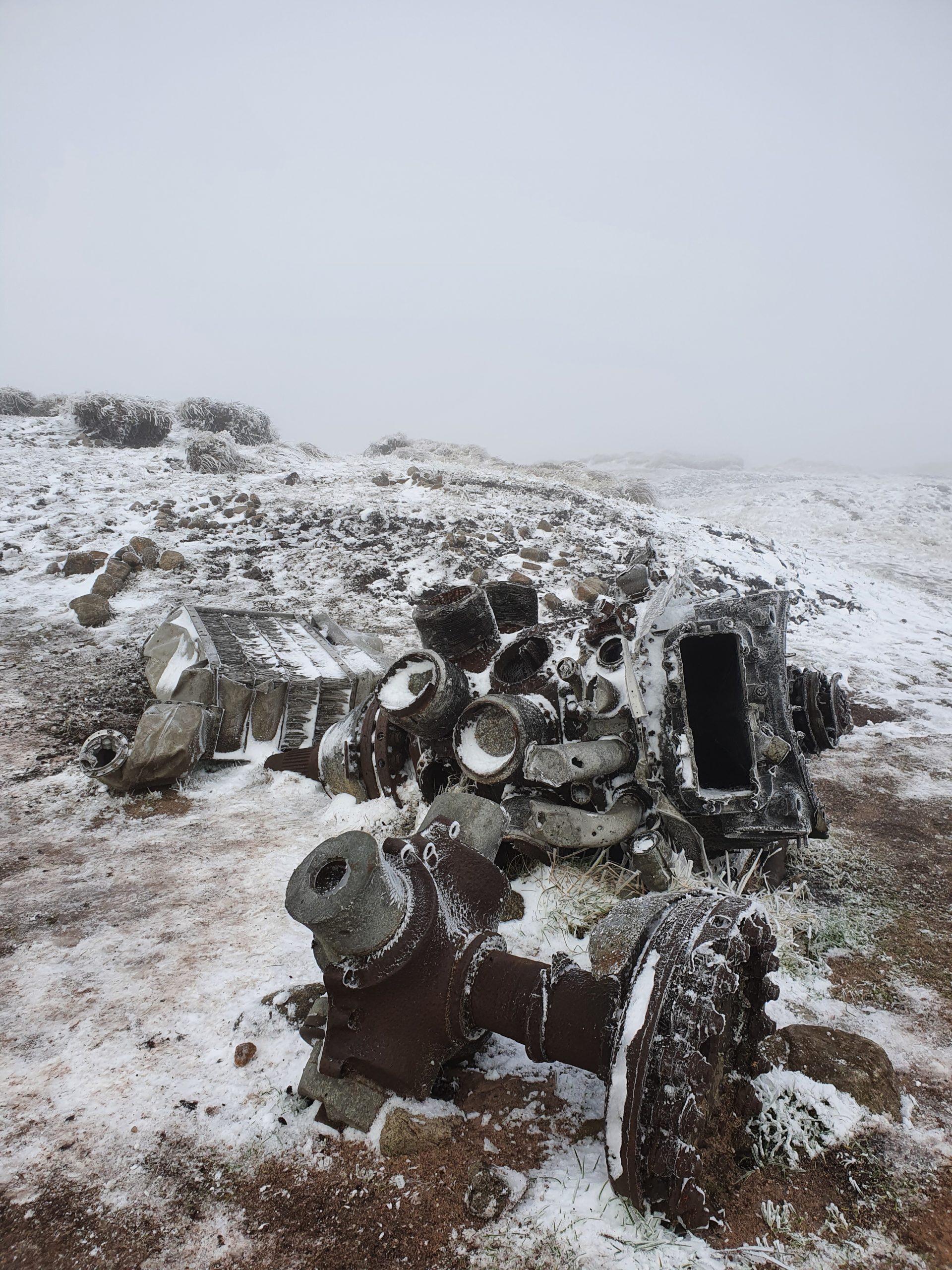
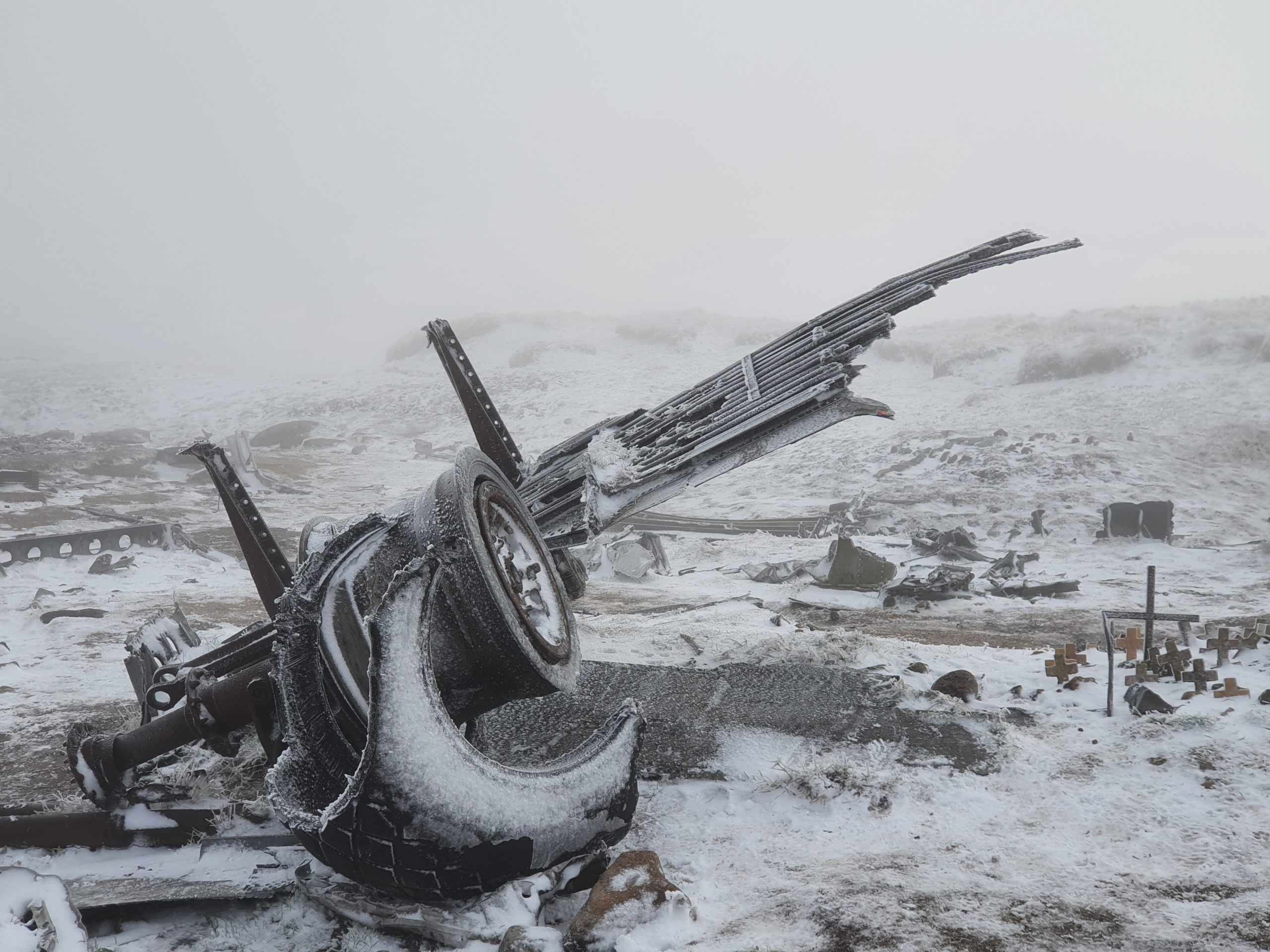
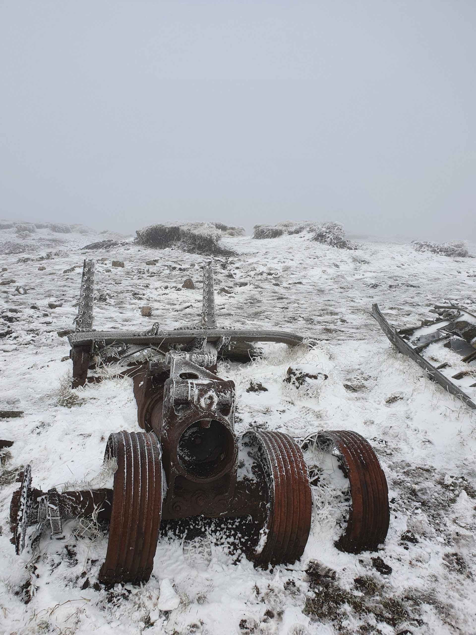
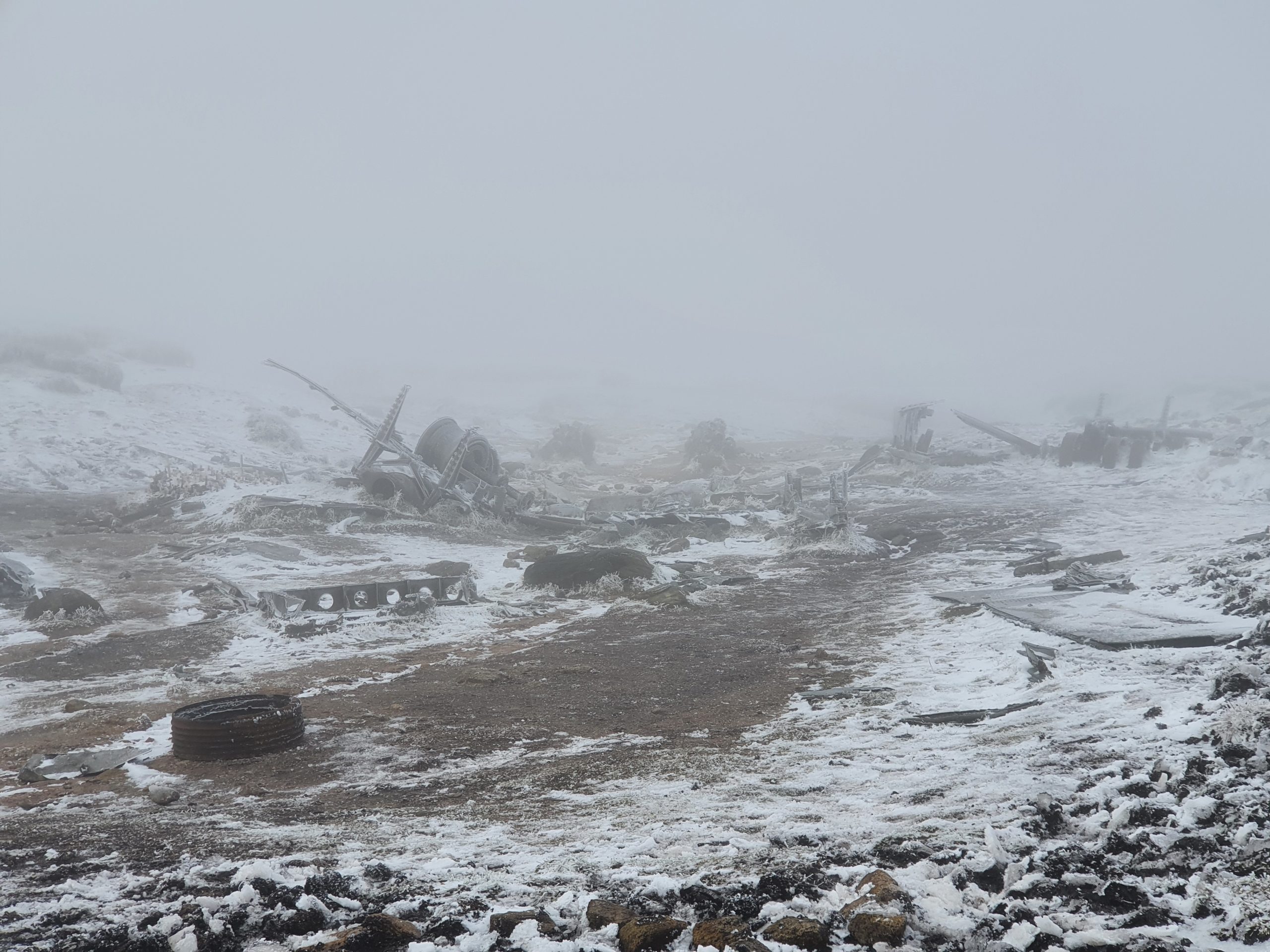
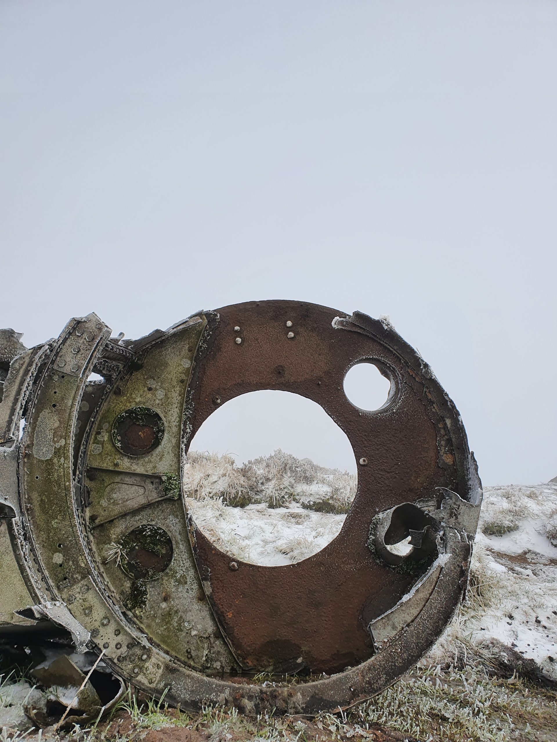
Despite the crash having happened over 70 years ago there is still a lot of wreckage at the site, and in relatively good condition considering the exposed location. Parts of the engines are recognisable as are the landing gear, one even still having part of the tyre intact. The weather only adds to the eery feeling of walking amongst the wreckage, and the efforts and fear of getting lost are all worth it now!


And while the walk back to the car isn’t quite as straight-forward as I hoped (I end up veering off track and having to cross some deep peat groughs, resulting in both of my feet being submerged in freezing water in different incidents!) I make it back to the trail and to the car well before darkness descends on the moor. At one point the sun even manages to break through the cloud and bathe the landscape in sunlight!
In better weather the site would be fairly easy to find and the walk isn’t too strenuous or difficult, but if like me you decide to tackle it during winter, make sure you’re dressed appropriately for the conditions and I’d recommend not doing it on your own or solely relying on your phone for guidance. But still, I made it, and my new coat definitely passed it’s warmth test!
This was the route I took… the step from Pennine Way to the Crash Site and back was where I went a little off-piste and found my way by using the GPS on my phone and heading in what felt like the right direction. And it took double the 1hr 30mins Google suggests… partly due to the number of photo stops I took, and partly with getting a little lost. But even without those it would still have been closer to 3 hours rather than 1 and a half hours!
Update… since nearly getting lost forever up on the moor I’ve bought myself a GPS watch. For anyone else who uses navigation and wants to attempt to find the wreckage, please find a link to a good route HERE. This is a little bit of a longer circular route than I did, but it sticks to the trails and also takes in Higher Shelf Stones which I didn’t get the chance to see. And please please please go prepared… I’ve read numerous news stories recently of people getting in trouble and having to get Mountain Rescue to come out and save them!
Be the first to leave a comment
Relateable posts
-
blog
-
United Kingdom
Jan 31, 2024Should Travel Bloggers Attend Travel Conferences?
In the dynamic world of travel blogging, where every journey is an opportunity for storytelling,…
-
blog
-
United Kingdom
Aug 24, 2021Goathland, Hogsmeade, or Aidensfield?? The Village with Legendary Identities!
Goathland is a sleepy little village high up in the North Yorkshire Moors National Park…